
GIS / Village Mapping
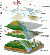
Geographic Information Systems (GIS) are a tool allowing a user to visually display, manipulate, and analyze digital mapping data to illustrate spatial relationships between objects in the real world. GIS is utilized by a number of Village departments to complete a variety of useful tasks.
Village GIS Data
Detailed mapping data is available in ESRI Shapefile file format and Google Earth file format. Please contact the Planning Department for further information at (914)762-6232.
Town of Ossining GIS Data
Town of Ossining Interactive Tax Parcel Tool - This database will provide you with information on tax parcels located in both the Town and Village of Ossining, such as:
- Section, Block, and Lot
- Tax Parcel Dimensions
- Property Class
- Property Owner
- Easements and Rights of Way
- Sanitary and Storm Sewer information
Westchester County GIS Data
Westchester County offers both paper maps and digital mapping data for public use. The County's Department of Planning can be reached at (914)995-4400. Below are links to several County mapping resources:
Mapping Westchester County: This interactive GIS tool will allow you to locate addresses, find elected officials and community services, view aerial photos, and access a variety of other useful data.
Other GIS Data available from Westchester County
Municipal Planimetric Data(ESRI Shapefile and Google Earth KMZ formats)
Countywide Datasets(ESRI Shapefile and Google Earth KMZ formats)
County Maps and Aerial Photographs: This link contains a list of County-level maps that can be purchased for a nominal fee. Some of these can be downloaded and viewed free in Adobe PDF format. Maps available include:
- Planning and Land Use Maps
- Transportation Maps
- Facility and District Maps
- Environmental Maps
- Base Maps
- Aerial Photographs
New York State GIS Data
New York State GIS Clearinghouse - The website above contains downloadable GIS data layers for all 62 counties in New York as well as data from state and federal agencies. Digital Orthoimagery is available and can be viewed through an online viewer. You will need a GIS application to access the downloadable data.
Other Maps/Downloadable Maps
Village of Ossining Zoning Map (2021)
Paper Maps
The Planning Department has a variety of paper maps available for viewing, including the following:
- Current Village Zoning Map
- Historical Village Zoning Maps
- FEMA 100 Year Floodplain Maps
- USGS Quadrangle Maps
Reproductions of the maps listed above can be made for a nominal fee. Please contact the Planning Department for additional information at (914)762-6232.
Paper Zoning Maps can be purchased for $10 from the Village Planning Department and Village Building Department, Ossining Operations Center, 101 Route 9A, Ossining, NY 10562.
*Disclaimer: The information and maps available on this web site are compiled from various sources and subject to constant revision. These maps should not be used to determine the relationship of various facilities to property lines, streets, buildings, etc. They are for advisory purposes and are intended to be used for general public inquiry only.